Seismic method survey
The technique of seismic tests is based on the generated of seismic waves (explosive, hammer, weight drop or vibrator), and then registration of the time that has passed from the moment of generated to the moment of arrival of the waves to the placed geophones along the seismic profile.
Knowing the arrival times of elastic waves to individual geophones, and the speed of expansion of elastic waves, it is possible to interpret, reconstruct the paths of seismic wave. Information about the structure of the studied environment is obtained based on the analysis of the paths of two basic types of waves:
a) refracted waves that generally expansion along the boundary planes or surfaces of two layers, almost horizontal;
b) reflected waves that initially go down, and then at some point are reflected and return back to the surface, and their expansion is almost vertical.
Based on the study of these two basic types of elastic waves, two basic methods of applied seismic were developed - refraction and reflection. For both of these types of waves, the travel time depends on the physical properties of the rocks and their structural position. Target of seismic surveys is to obtain data about rocks, especially on structural forms.
We use different seismic methods to solve different problems:
- High resolution reflective method,
- Refraction,
- Seismic tomography,
- Active and passive MASW (Multichannel Analysis of Surface Waves), SASW (Spectral Analysis of Surface Waves).
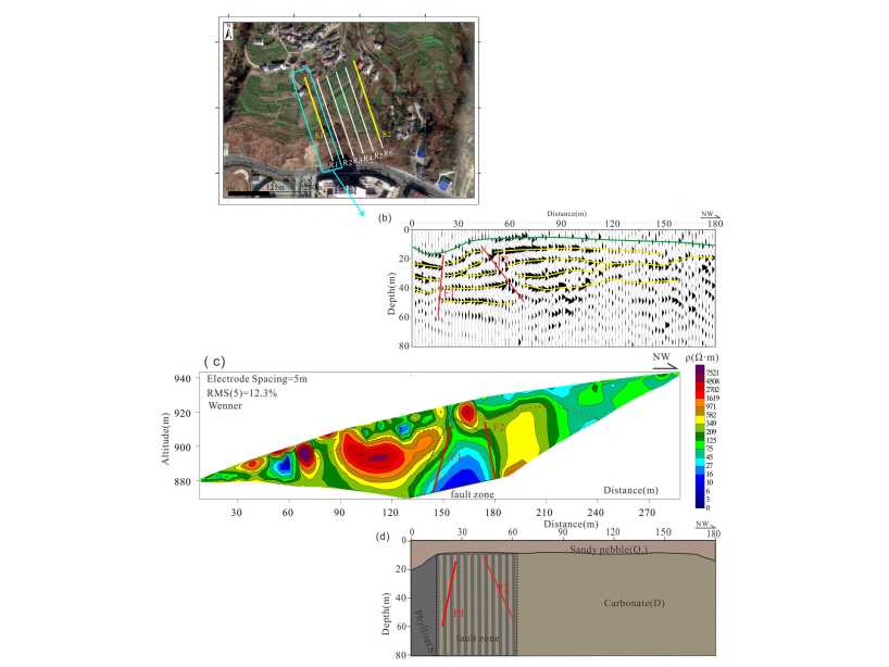
High-resolution reflection seismic method combined with geoelectrical tomography
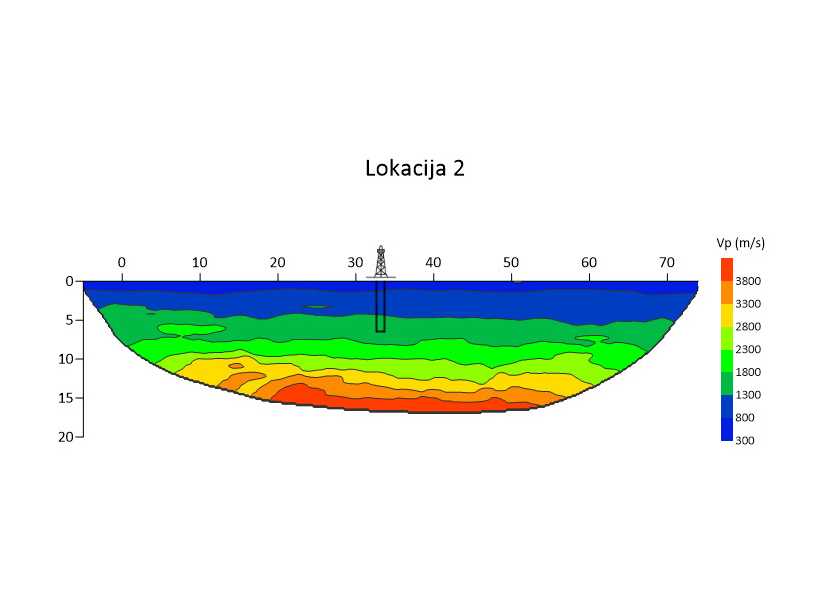
Seismic tomography
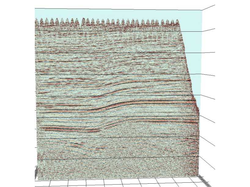
High resoulution reflective seismic
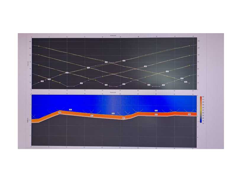
Seismic refraction
MASW (Multichannel Analysis of Surface Wave)
- Evaluate hardness (stiffness) of the soil by measuring the speed of the shear (transverse) wave (Vs) from the subsoil. The most common depths are up to 30 m. The shear (transfer) wave is a direct indicator of the stiffness of the material below the ground surface.
- Categorization of soil according to the Eurocode 8 standard for the purposes of designing and building buildings, as well as various types of geotechnical engineering projects.
- Soil mapping, detection of anomalies (existing utility pipes, voids due to collapse, heavily damaged rocks), assessment of material compaction during road construction and reconstruction, foundation assessment, calculation of Jung's modulus and shear modulus, tests on landslides...
- Ability to perform 1D, 2D and 3D recording.
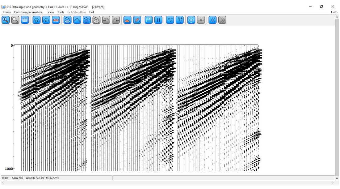
Seismic records
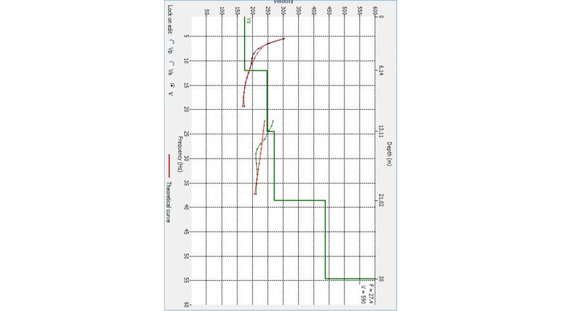
1D model
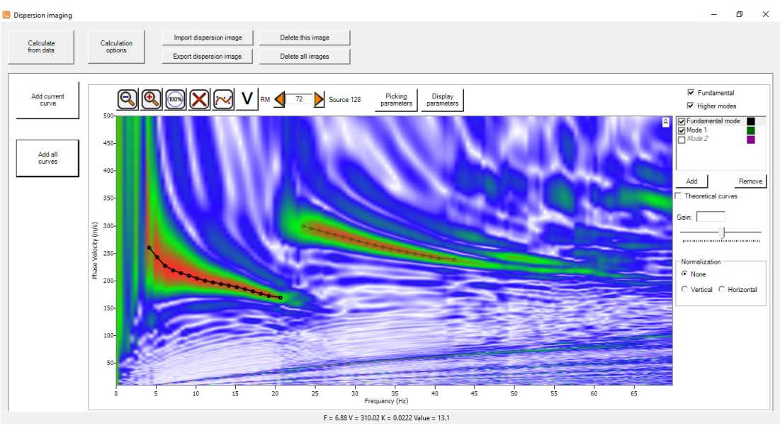
Dispersion analysis
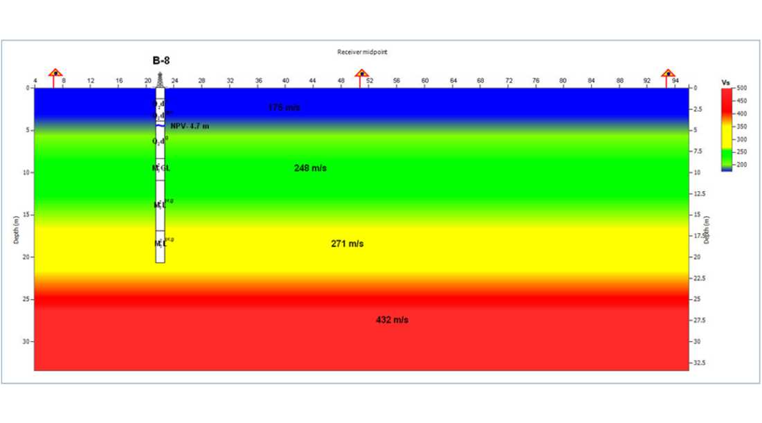
2D inversion model with borehole data
The advantage of seismic over other geophysical methods is determined by a number of factors, the most important of which are the following:
a) high accuracy of the obtained results
b) wide possibilities of solving various problems
c) the possibility of efficient study of geological sections from very small to depths several kilometers

